2.02.2012

Flat Rocks and Jack Pine

Photo courtesy of Dr. David Franzi, Center for Earth and Environmental Science, Plattsburgh State University


The Flat Rocks State Forest, known to the locals as "Flat Rocks", is a 371 acre New York State Department of Conservation State Forest located in Northeastern New York in the town of Altona.  Like many ecologically sensitive areas, its abioitc and biotic exist in a delicate balance. Because of the nearness of these elements within "Flat Rocks" it is defined both in the general abiotic sense as a sandstone pavement barren and in a more specific biotic sense as a jack pine barren.  Regardless of its broad or narrow definition, it is considered a globally rare phenomenon.  

SANDSTONE PAVEMENT BARREN
In Northeastern New York, the sandstone pavement pine barrens are "island ecosystems amidst the larger matrix of northern hardwood and mixed hardwood-conifer forests in the Champlain Lowland" (1). Sandstone pavement barrens are described "as open-canopy woodlands on very shallow soils over nearly level sandstone bedrock"(1).

As a marginal ecosystem, this area lives in a precarious balance with the climate an hydrology and is quite vulnerable to externalities either natural or man-made (1).  

"Flat Rocks" was created from the erosion caused by the melting glaciers over 10,000 years ago.  Massive flooding scoured the earth and stacked immense boulders in this area leaving behind a nutrient poor area.  Jack pine (Pinus banksiana) thrives in just those conditions, and subsequently "Flat Rocks" is considered one of the largest jack pine barrens in the Northeast. 


JACK PINE BARREN
"Flat Rocks" represents nearly the lowest point south that jack pine can be found in its natural habitat. "Jack pine is a relatively short-lived (<150 years), shade-intolerant, boreal species that maintains communities on the sandstone pavements because of its adaptations to fire and ability to survive in an area with thin (or absent), nutrient-poor soils and low seasonal water availability" (1).  

The barrens are defined by low density stands of jack pine with very little understory consisting primarily of:

Low blueberry (Vaccinium angustifolium)
Black huckleberry (Gaylussacia baccata)
Black chokeberry (Pyrus melanocarpa)
Sweetfern (Comptonia peregrina), and sheep laurel (Kalmia angustifolia). Three species of lichen comprise most of the ground cover (Cladonia uncialis, Cladina rangiferina, and Cladina mitis). Other ground cover plants include haircap moss (Polytrichum commune), bracken fern (Pteridium aquilinum), and Sphagnum spp.

CONSERVATION
As you can imagine, like much of the northeast, this place is most spectacular when viewed in the fall. 

There are many threats to this area and conservation is an ongoing endeavor.  Plattsburgh State University and the Miner Institute use this living laboratory and study its unique ecology.  One of the biggest challenge this area faces is fire.  Jack Pines are a fire species with serotinous cones.  The lichens, moss, and low shrubs and jack pine is a fire ecology that has been suppressed for years.  

Add to this the 1998 Ice Storm which devastated 11 million acres in ice affected areas, "Flat Rocks" is a metaphorical powder keg.  Research is being conducted to determine if selective thinning alone is enough to prevent catastrophic fire while maintaining the jack pine barren forest community.


MANAGEMENT PLAN
The NYS DEC is conducting an effort to Prepare a Management Plan for State Lands in Clinton County.  Unfortunately the public presentation is over, but any interested individual or organization wanting to be included on a mailing list for information about the development of the unit management plan or wishing to submit comments is encouraged by the DEC to contact: Forester Dan Levy by mail at NYSDEC, PO Box 296, Ray Brook, New York 12977-0296; by phone at 518-897-1291 or by e-mailing the region.

Works Cited:
2.  NYNHP Conservation Guide - Sandstone Pavement Barren http://www.acris.nynhp.org/report.php?id=9959
3. Krill, Allison;  Newell, Collete; O'Neil, Maggie; Phommala, Orathai; Adams, Kenneth (Faculty); 2004. Plant Community Succession Following Disturbances in a Pine Barren and Adjacent Hardwood Forest, Plattsburgh State University of New York. http://research.plattsburgh.edu/ejournal/ejournal/Volume1/krilletalvol1p1to16.pdf

2.01.2012

Japanese Lantern Slides


These amazing lantern slides come to us courtesy of E. Raymond Wilson who was awarded Japanese Brotherhood Scholarship for study and the building of friendships in 1926.  From 1926 to 1927 he toured Japan writing letters and taking these amazing images. 

Lantern slides are fascinating and inspiring. It makes me want to jump onto Photoshop and give it a try...the ultimate and original Hipstamatic Images!  You can earn more about the history of lantern slides here: http://memory.loc.gov/ammem/collections/landscape/lanternhistory.html


See more images here:
http://triptych.brynmawr.edu/cdm4/lantern.php

1.26.2012

New USDA Climate Zone Maps

Photo courtesy of National Gardening Association
To paraphrase Dylan in the worst possible way:  the times they are a changin'.  And so has the USDA's Climate Zone map.  The last map was issued in 1990 and the new map uses 30 years of data from 1976 to 2005 to offer a more accurate map.  In addition with the advent of digital GIS information, the USDA has data available for this analysis that did not exist or had yet to be digitally compiled previously.

These maps list average minimum temperatures for different latitudinal zones. Each zone is based on 10 degrees Fahrenheit with Zone 1 as the coldest (-60 to -50) and Zone 13 is hottest (60 to 70) (found only on Hawaii and Puerto Rico). Two new zones were added in hotter climates this year for a total of 13 zones.

So does this mean that climate change is real?  Is the jury really still out on this one?

Watch the video here:


To find out your zone check out this site:

Citation:
http://www.usatoday.com/news/nation/environment/story/2012-01-26/USDA-climate-zone-map/52787142/1

1.10.2012

Landscape Architecure and Engineering Apps Revisited

It seems like everyday, more and more new apps are given birth and it's hard to keep up! We are trying to update this post as we find more useful apps for landscape architects. Please let us know if you have any more suggestions and check out our first post with more apps that are useful for landscape architects.

Project Noah
“Foursquare meets nature.” Be a part of a wildlife study or know what  organisms have been observed near you. Fun app to have despite your profession, age or level of training. 


Graph Pad
Useful for drafting quick, to-scale drawings.


My Measures and Dimensions
This app could be really useful for initial site visits and for construction observation.


Clinometer- Measure Slope
We like this level because you can calibrate it. 


Manage Your Research 
For bloggers, students, professors or just the life-long student, Mendeley is a great way to organize your research and this app lets you take it with you wherever you go.

TED Talks
Be inspired on the go. 


Houzz and Pinterest- Find Design Ideas
If you don't use Houzz or Pinterest already, both are great websites to use if you are looking for design inspiration, especially when choosing materials. What has impressed me the most about Houzz, is that if you ask a question about the design (like, "what kind of stone is that?"), the designers themselves and others are quick to chime in. Pinterest is unique in that you can share your "pins" with your friends on facebook.
 

iTunes U- Design, Architecture and Landscape Architecture University Lectures
Although not an app, iTunes U has a wealth of available lectures from a myriad of universities and departments. Some of our personal favorites include the intro design course at NC State with Dean Malecha, Design Thinking, UC Davis's Design as Activism, and Anne Whiston Spirn's lectures at MIT, Sensing Place.


GPS Kit- A Better GPS App
This app is way better than Motion-X mentioned in the previous blog because you can upload multiple waypoints at a time and even group points and tracks. 


Leaf Snap- Plant ID
Take a picture of a leaf and ID a tree?! I'll believe it when I see it. I saw it!


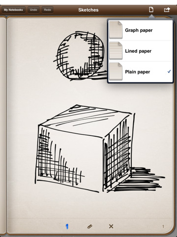
Penultimate- Goodbye Paper!
Pair this app with a stylus on your iPad and never buy a sketch book again!


iannotate PDF- edit PDF's 


logmein ignition- log onto your pc or mac 


Jesse's Work Flow Suggestion
"Snap a screenshot in google earth, bring it into procreate, sketch on it, then put it right into a presentation. Uses stylus, via adapter, and costs minimum of 1.99 for procreate (sketchbook pro works too)"
Thanks again Jesse! 

GoToMeeting- Join a Web Meeting
I use GoToMeeting at work quite a bit, and this app allows you to join meetings. It would be a lot better if you could host them, but hopefully that is soon to come.