I spy a circular-looking water body that looks almost like a ring, or maybe a flaming eyeball (maybe the Eye of Sauron?!) or perhaps an extremely large moat around the grandest of castles. Could it be a river or a lake? Is it Earthly? What is this un-natural looking ring of water?
 |
| Photo courtesy of NASA |
While virtually roaming the New York North Country and Quebec via Google Maps; I spotted a peculiar, circular waterbody with a land mass in the middle...or was it spotting me? This "eye of Quebec" is called Lac Manicouagan, which surrounds a body of land known as René-Levassuer Island. The island is home to 2 reserves-- Réserve de biodiversité de la Météorite and Réserve écologique Louis-Babel. Before the area was dammed in the 1960's, the water body was actually 2 water bodies-- Lac Mouchalagane to the west and Lac Manicouagan to the east.
So, what formed the two odd lakes side by side? As one of the "Seven Wonders of Canada," this now one waterbody is known as an annular lake or moat
1, which is a lake formed from a meteor impact and also called an astrobleme. When meteors have such a dramatic impact, they form complex craters with multiple rings, where the middle of the impact uplifts and creates a land mass similar to
Manicouagan's. The 60-mile wide impact was so intense, the molten rock took thousands of years to cool (between 1,500 - 5,000 years)
3. The crater is thought to be 213-215 million years old and may have been a part of a multiple impact event, as it forms a theoretical line on the late Triassic continents of North America and Eurasia with other craters, such as Red Wing Crater in North Dakota and Rochechouart Crater in France
4. Interestingly, because of its unique geology, it is considered as a useful analog of other impact structures on other planets, such as Noachian Mars, for space exploration and study
8.
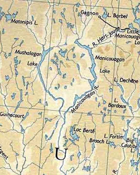 |
| 1962 Map of the Lakes before "Damnation" 1 |
 |
The reserve today 2
|
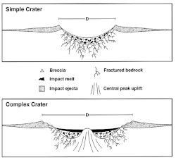 |
Diagram courtesy of Wikipedia 4
|
The uplifted region-- Mount Babel and its island, Rene-Levasseur Island-- is not only geologically interesting and the second largest lake island in the world, it has a wealth of biodiversity due to its quick transition from the boreal forest to tundra. The reservoir and island are located in the Boreal Shield ecozone and the Central Laurentians ecoregion 9. The rugged terrain hosts species from the boreal ecosystems, which are dominated by black spruce, fir, alder, jack pine, sphagnum and architectural sightings of krummholz; and tundra communities dominated by lichens and blueberries. 91% of the forest stands on the island are older than 100 years and the island houses almost 1,651 hectares of peatland 4,5. Protected peatlands are scarce, as only 3.5% of Quebec's peatlands are protected 5. Moose and caribou are common on the island. Atlantic salmon,
lake trout and
northern pike can be found in the reservoir 1.
|
Impact melt cliff of the central peak island. 3
|
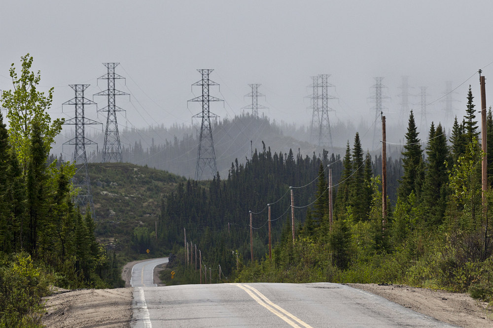
In the 1960's the lake was dammed for hydroelectric power and now supplies power all the way down to New England. The height of the dam is 214 m and some research suggests that the magnitude of the dams in this region have induced seismic activity 10. The lake gets the lowest during the heat of the summer, when New Englanders turn on thier AC's. Wikipedia reports that the chief engineer for the dam, Rene Levasseur, and Dan Johnson, the Premier responsible for the project, both died young from heart problems. Apparently, the native Innu believe that just as the men clogged the rivers, the Earth's veins and arteries, the creator responded by clogging theirs, a belief which could reflect the cultural conflicts of the region. However, this may simply be a rumor, since Wikipedia has no source for this statement. However, there are reports of several conflicts between the native communities and the energy companies. Nonetheless, it fits well into the story of Tolkien's evil eye, the Eye of Sauron....my precious!
A non-profit group, SOS Levasseur acts to protect the unique ecological and cultural resources of the island from destructive activities such as logging and mining, and performs research on the island. Another organization which encompasses all the reserves in the area is called Réserve de la biosphère Manicouagan-Uapishka, designated by UNESCO in 2007. We can't help but wonder what this place would be like if the dam were never built or the logging never occurred. Réservoir Manicouagan looks like a fascinating place to visit and we just might have to add it to the bucket list!
 |
| Dams within the Manicouagan-Outardes complex. 10 |
 |
Blueberry in a lichen in nearby Mondiale Reserve.
|
 |
| Innu folks fishing. Photo courtesy of Photo Lorcan Otway 1994. |
 |
Deforestation on the island. Photo courtesy of Greenpeace.
|
 |
Ancient forest of the island 7
 |
Vegetation found on the island by SOS 7
If anyone knows this species, please let us know!
|
|
1 http://www.staff.science.uu.nl
2 Gouvernement du Québec, 2009. Réserve de biodiversité de la Météorite – Conservation Plan. Québec, Ministère du Développement durable, de l’Environnement et des Parcs, Direction du patrimoine écologique et des parcs. 24 pages.
4 Wikipedia
686672 (1998): 171-173.
8 Spray, John G., Lucy M. Thompson, Marc B. Biren, and Catherine O’Connell-Cooper. "The Manicouagan impact structure as a terrestrial analogue site for lunar and martian planetary science." Planetary and Space Science 58, no. 4 (2010): 538-551.
9 Ecological Stratification Working Group, 1996. A National Ecological Framework for Canada. Agriculture and Agri-Food Canada, Research Branch, Centre for Land and Biological Resources Research, and Environment Canada, State of the Environment Directorate, Ecozone Analysis Branch, Ottawa/ Hull. Report and national map at 1:7 500 000 scale.
10 Leblanc, Gabriel, and F. Anglin. "Induced seismicity at the Manic 3 reservoir, Quebec." Bulletin of the Seismological Society of America 68.5 (1978): 1469-1485.