Showing posts with label apps. Show all posts
6.01.2012
ParkScore: How Good are Your City's Parks?
ParkScore is a project developed by The Trust for Public Land, one of the nation’s largest national nonprofit organization working to create and improve neighborhood parks. There are many other similar neighborhood/park accessability ranking systesms (WalkScore and BikeScore) and ParkScore is the newest of those systems.
Covering 40 major cities in the U.S., ParkScore enables any park lover to create customized maps for each city, evaluate park access by neighborhood, and determine where parks are still most needed, writes Peter Harnik, ASLA, Director, Center for City Park Excellence at TPL. The goal of the project is to help communities lobby for more parks and better parks. “We hope that city leaders, park providers and park advocates will use the information at ParkScore as a valuable tool to help plan park improvements. Over the long run, a rising ParkScore will mean healthier people, higher property values, and more vibrant and livable communities.” (1)
The new tool is not as comprehensive as the others in that it ranks the park systems of the 40 most populous U.S. cities on a scale of 0-100, with an easy rating system of 0-5 park benches. The top 10 cities:(1)
1. San Francisco (74.0)
2. Sacramento (73.5)
3. New York (72.5)
3. Boston (72.5)
5. Washington, D.C. (71.5)
6. Portland (69.0)
7. Virginia Beach (68.5)
8. San Diego (67.5)
9. Seattle (66.5)
10. Philadelphia (66)
And the five cities at the bottom of the list:
35. San Antonio (35)
36. Indianapolis (31.0)
36. Mesa (31.0)
38. Louisville (29)
39. Charolotte (28.5)
40. Fresno (21.5)
For the methodology related to ParkScore, click HERE and make up your own mind about it's usefulness.
(1) http://dirt.asla.org/2012/05/31/how-do-the-parks-in-your-city-rank/
1.10.2012
Landscape Architecure and Engineering Apps Revisited
It seems like everyday, more and more new apps are given birth and it's hard to keep up! We are trying to update this post as we find more useful apps for landscape architects. Please let us know if you have any more suggestions and check out our first post with more apps that are useful for landscape architects.
Project Noah
“Foursquare meets nature.” Be a part of a wildlife study or know what organisms have been observed near you. Fun app to have despite your profession, age or level of training.
Graph Pad
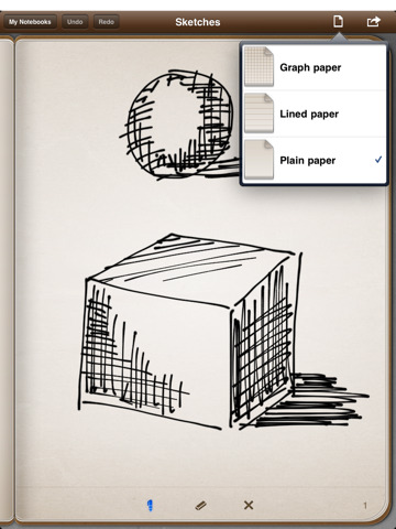
Useful for drafting quick, to-scale drawings.
My Measures and Dimensions
This app could be really useful for initial site visits and for construction observation.
We like this level because you can calibrate it.
Manage Your Research
For bloggers, students, professors or just the life-long student, Mendeley is a great way to organize your research and this app lets you take it with you wherever you go.
TED Talks
Be inspired on the go.
Houzz and Pinterest- Find Design Ideas
If you don't use Houzz or Pinterest already, both are great websites to use if you are looking for design inspiration, especially when choosing materials. What has impressed me the most about Houzz, is that if you ask a question about the design (like, "what kind of stone is that?"), the designers themselves and others are quick to chime in. Pinterest is unique in that you can share your "pins" with your friends on facebook.
iTunes U- Design, Architecture and Landscape Architecture University Lectures
Although not an app, iTunes U has a wealth of available lectures from a myriad of universities and departments. Some of our personal favorites include the intro design course at NC State with Dean Malecha, Design Thinking, UC Davis's Design as Activism, and Anne Whiston Spirn's lectures at MIT, Sensing Place.
GPS Kit- A Better GPS App
This app is way better than Motion-X mentioned in the previous blog because you can upload multiple waypoints at a time and even group points and tracks.
Leaf Snap- Plant ID
Take a picture of a leaf and ID a tree?! I'll believe it when I see it. I saw it!
Penultimate- Goodbye Paper!
Pair this app with a stylus on your iPad and never buy a sketch book again!
iannotate PDF- edit PDF's
logmein ignition- log onto your pc or mac
Jesse's Work Flow Suggestion
"Snap a screenshot in google earth, bring it into procreate, sketch on it, then put it right into a presentation. Uses stylus, via adapter, and costs minimum of 1.99 for procreate (sketchbook pro works too)"
Thanks again Jesse!
GoToMeeting- Join a Web Meeting
I use GoToMeeting at work quite a bit, and this app allows you to join meetings. It would be a lot better if you could host them, but hopefully that is soon to come.
4.08.2011
Best iPhone + iPad Apps for Landscape Architects
Introduction.
In celebration of receiving my iPad soon, I put together a list of apps that may be useful for those of us in the landscape architecture field. I am sure this list will become outdated soon enough, but nonetheless, here it is! Please feel free to add to or comment on any of these apps! See part 2 here.
Basics.
This is the app I use to record tracks and waypoints when I am in the field (mostly doing large scale vegetation analysis). If you want to take pictures with your iphone, this app will geotag them for you if you use the camera interface within the app. You can email your waypoints, tracks or geotagged photos to yourself and view them in google maps, google earth or ArcGIS. Doesn't quite replace a GPS unit, but has pretty good accuracy.
Botanical.
Dirr's Tree and Shrub Finder ($14.99)
So if you studied landscape architecture, I don't need to explain this one. I use Dirr's DVD all the time at work, and now you can have it on your mobile apple device! Not nearly as awesome as Dr. Brahm's labs, but maybe one day there will be a Braham app, with stories and all.
Tree ID ($2.99)
A pretty good app for when you forget how many leaflets a pignut hickory has.
What's Invasive?! (free)
Contribute to invasive species mapping and use to ID invasives in the field. Participatory sensing!
A collection of our native flora.
Botany Buddy ($9.99)
Over 2,000 species. ID or choose plants.
Civil Engineering.
I have not tried this one yet, but it has pretty much any calculator you need
Rain Harvest (free)
Quickly calculate runoff.
Drafting.
AutoCAD WS (free)
View, edit, annotate and share CAD files in the field. The best part is that you can view a google map aerial underneath your CAD linework (well, only if your drawing is georeferenced, which by now all CAD drawings should be, come on people!).
Drawing.
Sketchbook Pro ($7.99)
Can't wait to try this app on my iPad. Rates as one of the best apps out there.
.
Google SketchUp Cookbook ($6.99)
Tutorials.
GIS and Mapping.
ESRI ArcGIS (free)
View data, collect data with your iPhone or iPad GPS, view attribute info. It's a start in a good direction. Geoprocessing to come.
Soil Web (free)
Access real-time USDA-NRCS soil data in the field!
Miscellaneous.
Designnear- with a database of over 575 projects, find a cool design project near you!
Any Audubon apps!
Subscribe to:
Posts (Atom)